Product Brochure
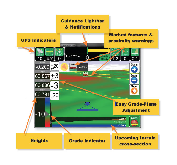
LevelGuide Screen display
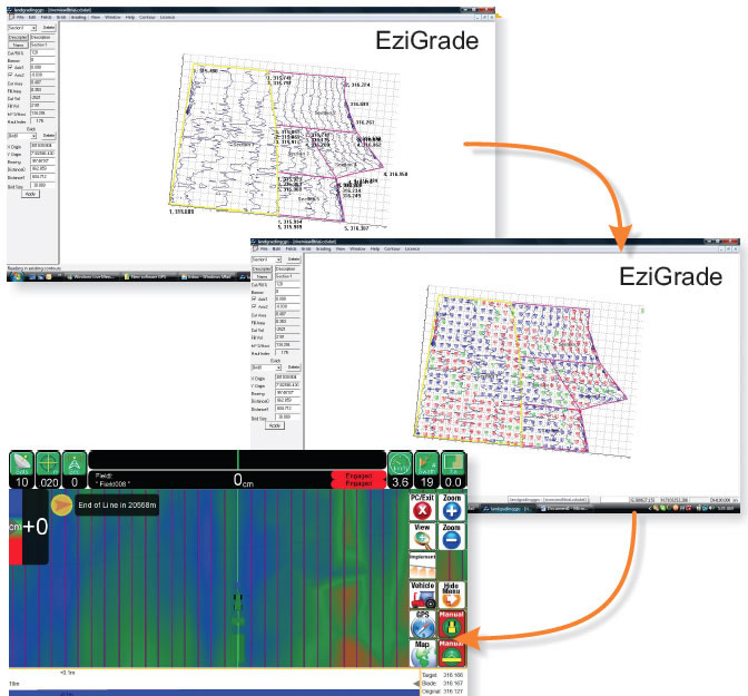
EziGrade Screen display 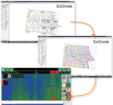

Frequently Asked Questions
- The advantages of using GPS over laser are that you are not limited to operating close to the base station you can move up 4km from the Base. A field design surface can be loaded into the PC for the controller to allow the blade to follow in the field. This can be a flat plane, a combination of planes or even a 'curved' surface for more undulating fields. The only boundaries are the field boundaries.
- The vertical accuracy of the GPS is typically 10 to 15 mm. Combined with other inaccuracies associated with land leveling, such as hydraulic lag, tyre flexing, field trash and clod size, it on a par with or better than laser systems used in agricultural land leveling.
- Distance from the Base. The vertical accuracy is affected by the distance the rover is operating from the base station. However up to about 4 km from the base station there is very little change in accuracy.
- Field Designs. Levelguide is based around a cut and fill design package called Ezigrade and the Civil Design package, CDS. This package can be used to create simple designs with planes and ‘curved’ surfaces through to more complex ones with many multiple planes, banks etc.
- Design Services Landform Survey and Design in conjunction with other Irrigation field designers can either create designs or help find a local designer who can do this for you.
- Simple grading for building ditch pads and drains There is no need to have a field design, levelguide can be setup simply like a laser by setting grades in the PC. The best part about this is this can be done from the tractor seat and these grades are stored in the PC so if you wish to return to this 'design' latter on it is easy.
- Other Design Packages If you have field designs from other design packages these can be converted to go into Levelguide. These designs can be either digital or on paper but the base survey information needs to be in a digital format. Landform Survey and Design and its associates have the capability of converting many different file formats so they can be loaded into Levelguide, some of these include 12D designs and Trimble designs.
- AutoSteering and Leveling These functions can both happen together if you wish. This requires 2 Rover GPS’s to be mounted one for autosteering the tractor with the antenna on the bonnet of the tractor and one for controlling the blade with the GPS antenna on the bucket.
- What sort of implements can Levelguide be attached to? Levelguide can be used on any implement with a blade. Hydraulics on the blade need to be external (not three point linkage). Even landplanes and grader blades (with hydraulic wheel lifts) can be operated with levelguide.
- What sort of hydraulics are required? On larger later model tractors, such as Case, New Holland and John Deere the hydraulic remotes can be used to control the blade in automatic mode. With other brands of tractor a proportional valve will be required to operate the blade.
- Can Levelguide be used manually? Levelguide can be used either manually or in automatic operation. In the manual mode the operator follows the display on the screen to raise and lower the blade, in automatic mode the Agguide PC operates the hydraulics on the implement.