

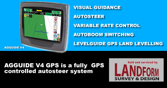
AgGuide GPS Autosteer
Key Features
Comprehensive mapping
AgGuideV4 allows for recording, storage, analysis, printing and record keeping for a virtually unlimited (depending on memory and storage) number of farms, fields, jobs, field perimeters, runlines, marked points, spray and weather data, coverage and elevation maps.
On-screen and audible notification of important upcoming obstacles (e.g trees, rocks, poles, perimeters) reduces the risk of in-field collisions.
Guidance
On-screen visual guidance, as well as steering-wheel- motor and full CANBUS and cm accuracy hydraulic auto-steer guidance are expertly implemented, allowing for broadacre, inter-row-sowing and controlled traffic row-crop operations. Racetrack, contour, parallel, and pivot guidance are all included.
Automatic Boom Section Spray and Rate Control (SprayGuide)
Farmscan was one of the first in the industry to provide automatic boom section control – reducing chemical usage and overlap or underlap. Rate control provides fingertip regulation of application rates.
Record keeping
All mapping data is retained indefinitely allowing for full record keeping of all in-field, sowing, spreading, fertilizing, spraying and harvesting operations, as well as printing, area and product cost analysis.
Easily copy data to your office computer to view, zoom in, and print all maps. Multiple map layers can be overlayed for comparison.
Implement guidance (RigGuide)
Focus your high-accuracy farming where it matters most – at the implement – using our first-in-the- industry implement control system.
Variable Rate Control (VRC)
This soon-to-be-released addition fully integrates Farmscan’s highly-respected VRC solution into AgGuideV4 allowing rate control of up to 4 products including on-screen fingertip control.
‘Laser’-levelling (LevelGuide)
AgGuideV4 provides a comprehensive system to control a grader blade/bucket to replicate and improve upon standard laser levelling tasks – at a fraction of the standard cost and hassle.
Single planes can be easily marked with three points, or a combination of points and defined slopes.
With the use of companion software or design services, full-multi-plane cut-fill maps can be used with powerful coloured on-screen mapping including contour profiling. Contour banks are also easy to make.
Multi-camera display
Images from up to 4 cameras can be simultaneously displayed on-screen, with any enlarged to full screen with a simple touch of the finger. Reduce cab clutter by combining all your camera inputs into one screen.
- On-screen and audible notification of important upcoming obstacles (e.g trees, rocks, poles, perimeters) reduces the risk of in-field collisions.
- Add FlexiSteer™ wheel motor assist
- CANBUS autosteer available for most modern vehicles (Plug & Play)
- Hydraulic precision auto-steer for broadacre, inter row so wing and controlled traffic row crop operations
- CORS/NTRIP and Radio corrections are fully implemented for RTK accuracy. Racetrack, contour, parallel, and pivot guidance are all included.